How to enter your Inclinometer data into In-Site manually
1. Introduction
If
you have accidentally deleted or lost your Inclinometer readings and
you have a manual copy of the readings, it is possible to enter them
into your In-Site database. Manual data entry into In-Site is a very
long process and can be a bit tedious, however it is possible.
2. How to enter your data manually into In-Site
- Open In-Site and the database you wish to manually input readings into
- Select
the database path name in the database menu (left window) the path is
commonly C:\Program Files\In-Site\database_name.mdb. Or this can be
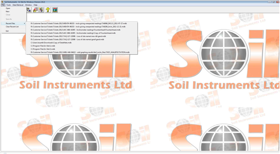
found under the 'Recent files' header (Figure 1.)

Figure 1. Selecting the database you wish to import that data into
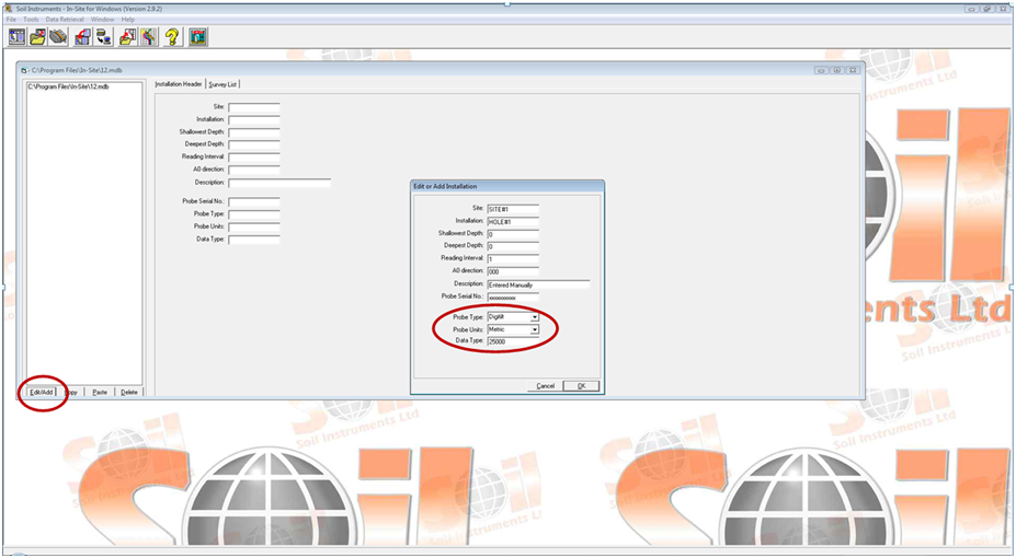
- With the database path name selected click on the "Edit/Add" button at the base of the database menu (Figure 2.)

Figure 2. Selecting Edit/Add button and entering the relevant information
- You
will then be presented with 'Edit or Add Installation' screen. Enter in
the relevant information. Set the probe type to 'Digitilt', Probe units
to 'Metric' (if using a metric system) and finally set the 'Data Type'
to 50000 (Figure 2.).
- Once complete select 'Ok' and confim you wish to add the survey in the next window.
- You
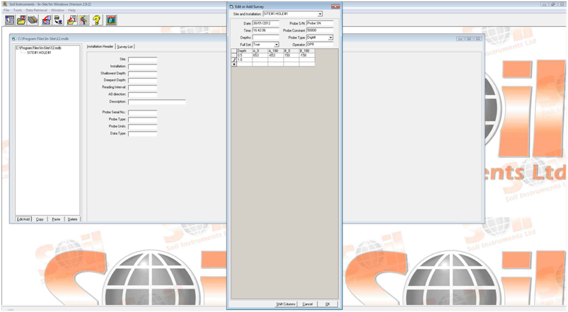
will then be presented with an 'Edit or Add Survey' window which will
allow you to enter the survey data. Firstly ensure the header details
are correct. Paying particular attention to the 'Probe Constant' as this
has a habit of reverting to 25000 (it should be 50000 for a metric
probe), and the 'Depth' (Figure 3.).

Figure 3. Entering borehole information and readings at each depth
- Start to enter your data into the cells provided. Please be aware that the value entered at this stage should be mm x 100 (Figure 3.).
example 6.53mm should be entered as 653. If 6.53 is entered directly
the software interprets this as 0.0653mm and will round this to the
nearest 0.01mm, this is all due to data handling and resolution
accuracy.
- Once all the data has been entered, re-check the header information is correct, specifically the Depth. Then select "Ok"
- The data will then be entered as a survey in the database window and can be plotted within a deflection graph.
